Le Ballon Bleu
Where we are.
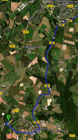
 'Le Ballon Bleu' is situated about 1 km from the centre of the village of Sauret-Besserve, in the direction of Les Ancizes and the Fades-Besserves reservoir lake. Sauret-Besserve is some 5 km away from St-Gervais d'Auvergne. From Paris it's about 450 km over Orléans and the A71 motorway. As the crows fly, we are 28 kms NW from the summit of the puy-de-Dôme and some 40 kms from Clermont-Ferrand.
How to get to Le Ballon Bleu
 Coming from the north, you will leave the A71 at Montmarault and from there you will follow Saint-Eloy-les-Mines and Saint-Gervais d'Auvergne. Once there, follow the road signs to Sauret-Besserve and/or to the Fades-Besserve lake.
From the south, west or east you will arrive over the A89 (Bordeaux < > Lyon) and take the exit Manzat. From the exit, you stay on the road that traverses Manzat and passes Chateauneuf-les-Bains, in the direction of Saint-Gervais d'Auvergne. The distance from the highway exit is about 25 minutes.
Our formal address is: 130 Rue des Buissons, Les Buissons, 63390 Sauret-Besserve, France (Earth, Sol system, Milky Way).
Phone (landline): +33 (0)4 73 85 31 57 Mobile phone: +33 (0)6 25 06 24 38
 Le Ballon Bleu by Google and GPS
By far the easiest way to find our exact position is to type 'Le Ballon Bleu' in Google Maps on your computer or smartphone before you leave. Google will show you the itinerary all the way to our front door. Better print the map and and itinerary, as mobile internet is almost non-existent where we live, and certainly not good enough for live Google-mapping...
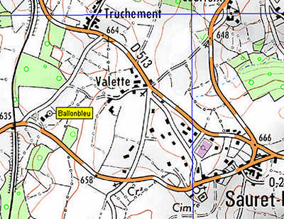
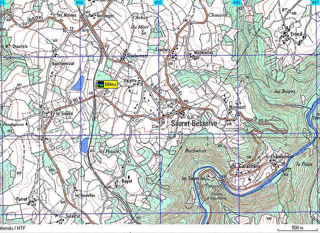
Since end 2023, our 'new' official street address at 130 Rue des Buissons is also known to Google Maps and similar web planners. However, car GPS nav systems tend to lag years behind, so they will take you to the 'Lieu dit' (a more general settlement or geographical area) of Les Buissons, and inevitably take you to the wrong street, closer to the village then where we are. So only use your car nav system to get to the village center, find the church and from there, leave the village in the direction of Les Ancizes/Fades Besserve on the main road (the church will be on your left and the road will descend). 500 metres further the car nav will wrongly tell you to turn right into a street with a few villas. Don't turn right but continue on the main road almost a kilometre until you reach an old railway crossing. Just before that crossing, turn sharp right and up onto a small road. From end 2023 this will actually have a sign 'Rue des Buissons'. Our brown wooden house is 130 m further on your right (the number system is metric, there actually are just two houses and ours is the second). Our mailbox along the road is, of course, blue.
For those who like to navigate on geographical coordinates: N 45.99533° E 2.79766° . (N 45° 59'.43" E 002° 47'.52")
Click on the small maps (aerial photos) below to load larger versions suitable for your smartphone screen, useful for the final leg of your journey. If you still can't find us (because it's still dark if you are coming for an early-morning balloon flight), call us when you have arrived in the village centre near the church and we'll talk you through the last km or so. :-)